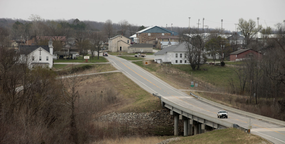
Texas County, Missouri. near the town of Plato (shown here) is the population center of the United States, according to the 2010 census. (AP Photo)
The center of population in the United States has been steadily moving westward since 1790.
The mean center of population is the place where an imaginary, flat map of the United States would balance perfectly if all residents were of equal weight. The US Census Bureau comes out with this figure every 10 years.
Historically, the movement of the center of population has reflected how we’ve grown as a country, from the settling of the frontier, to waves of immigration, and the migration westward and to the southern states.
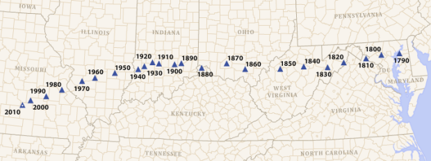
The US centers of population since 1790. (US Census Bureau)
Chestertown, Maryland was named the first center of population after the first census was conducted in 1790.
Since then, the center of population has steadily moved westward, across Maryland, Virginia, West Virginia, Ohio, Kentucky and Indiana, to its current location near Plato, Missouri, located almost 873 miles from Chestertown, Maryland, the first center of population. (That’s not to be confused with the geographic center of the United States which is located near Lebanon, Kansas.)
While the center of population has moved steadily westward, it’s also angled down toward the southwest in recent decades. The invention of air conditioning nearly a century ago contributed to the population shifting southward as well, especially in the latter half of the 20th century.
Vox has put together this interesting video illustrating this shift and the reasons for it.










I hope we don’t see how climate change with its rising sea levels, polar vortexes, more intense thunderstorms and general rising temperature drives the center of population.
I wonder where have the decendants from 1790 spread to now?
With the illegal immigration from the South and refugees pouring into the US from God knows where, these population statistics will be meaningless soon. Just what we need is another million penniless, uneducated refugees.
a nation of immigrants