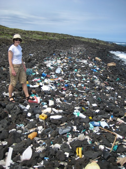
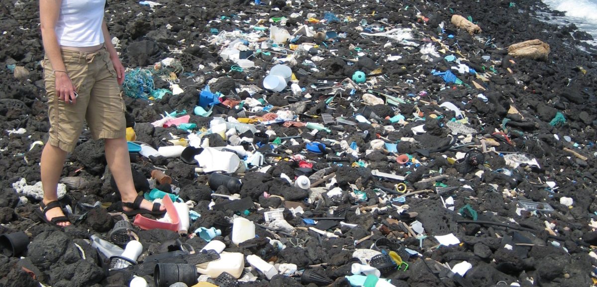
Plastic ocean debris littering Hawaiian shoreline. Hawaii is located near the center of the North Pacific gyre where debris tends to concentrate. (NOAA)
A team of volunteers, sailing in a flotilla of some thirty vessels, has successfully completed its month long research expedition through the eastern portion of the infamous Great Pacific Ocean Garbage Patch.
The first group of boats from the 30 vessel fleet, along with the Ocean Starr, a former NOAA research vehicle which served as the expedition’s “mother ship”, ended their journey when they sailed into in the port of San Francisco on Sunday, 8/23/15.
The Dutch environmental organization founded by Boylan Slat, called the Ocean Cleanup conducted its Mega Expedition Reconnaissance Mission through the massive collection of marine debris so that it could gather data to find out how much plastic is actually floating in the Pacific Ocean.
Nearly 8 million tons of plastic, mostly from land enters the ocean every year said a recent study.
Researchers say that portions of this huge collection of plastic, along with other forms of marine debris, gathers in five areas of the world’s oceans where the currents meet called the gyres.
A 2014 study found that currently there are at least 5.25 trillion pieces of plastic floating in the oceans with about third of it concentrated in the Great Pacific Garbage Patch.
The impacts of plastic pollution include harm to the environment, economy and human health.
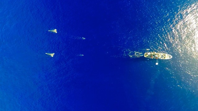
The Ocean Cleanup’s Mega Expedition mothership R/V Ocean Starr is shown here deploying the two 6 meter-wide ‘mega nets’, two ‘manta trawls’, and its survey balloon with camera at the center of the Great Pacific Garbage Patch. ((C) The Ocean Cleanup/Skyframes)
About one million seabirds and one-hundred thousand marine mammals die every year due to plastic pollution, according to a 1997 study.
Toxic chemicals that are found in and can be amplified by the plastic pollutants enter the human daily diet through fish and other edible sea creatures who consume plastic polluted food.
Health effects that have been tied to these food borne chemicals include cancer, birth defects, immune system problems, and childhood developmental issues.
The Ocean Cleanup group plans to use the gathered data to create the first high-resolution map of plastic in the Pacific as well as to help in the preparation for the organization’s large scale ocean cleanup project that’s planned for 2020.
The thirty vessels sailed in parallel with each other over a 3.6 million square kilometer course in the Pacific Ocean. Over the month long period, the boats made around fifty crossings between the U.S. West Coast and Hawaii to conduct surveys on the amount of plastic they came across.
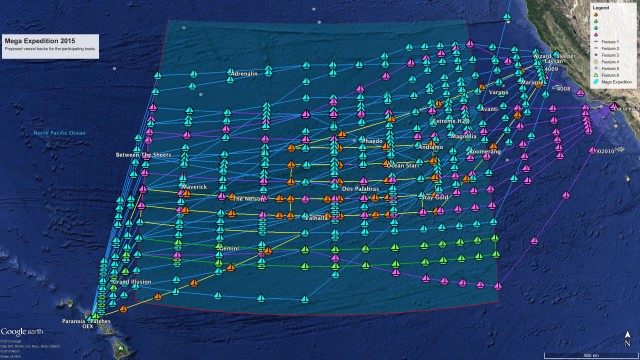
Map showing the 50 transects the Mega Expedition will perform based on routing information provided by the skippers before they left port.
Copyright: The Ocean Cleanup ((C) The Ocean Cleanup/Lys-Anne Sirks)
The expedition used a variety of measurement techniques to gather data. Each of the boats towed a trawling net so that they could sample some of the smaller debris floating in the ocean. They tallied the larger pieces of debris with a special smart phone application called “The Ocean Cleanup survey app.”
To study large objects like ghost nets – fishing nets lost or left in the ocean – and debris from the 2011 Japanese Tsunami, the researchers also used an aerial camera system and giant nets that were aboard the Ocean Starr mothership.
According to a report from the Associated Press, most of the trash found by the expedition, including a one ton fishing net, were in medium to large pieces.









This is every-cloud-has-a-silver-lining thinking. Could there be objects of historical or archaeological value among the marine debris?
How can i help increase awareness of the ills of plastic use in my country ? (Fiji )
I suspect i have similar challenge as other developing third world countries.
Where can I access the final report when it does come out ?
Must express thanks to all those that have made this possible.
Most grateful
Aloha Rick from Kauai,
I am a cartographer from the ’70s. So when your headline says this expedition mapped a portion of the gyre, I expect to see a map. Actually, “chart” is the correct term that refers to large water bodies. I see no chart of the gyre. I see where the points of data were gathered and that they pulled into port a week ago. Assembling the data into what might look like a familiar topographic map hopefully will reveal the breadth and depth of the gyre. This would appear to be an inverted topographic map, illustrating the concentration(s).
Hello Tek!
Sorry about not having the map made by the recent expedition taken through the Great Pacific Ocean Garbage patch. But I believe the folks from the expedition’s organizers the Great Ocean Cleanup need to process and compile all the data gathered by all participants over their nearly month long expedition. Hopefully once the map or chart is completed, released to the public and permission is granted I’ll be able to post some graphics of it.
Thanks for commenting
Rick Pantaleo